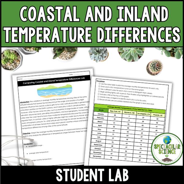
Engage your students in real-world data analysis with the Comparing Coastal and Inland Temperature Differences Lab. In this hands-on activity, students graph and interpret average monthly temperatures from coastal and inland cities to uncover how geography shapes climate patterns and temperature ranges throughout the year.
Why Teachers Love This Lab:
✔ Data Analysis & Graphing Practice – Students build and interpret line graphs to visualize real climate trends
✔ Critical Thinking Focus – Encourages students to analyze how factors like proximity to water, elevation, and geography impact temperature
✔ Flexible for Multiple Levels – Easily adaptable for middle school and high school learners
✔ Real-World Application – Connects climate science to meaningful, observable patterns in everyday weather data
What’s Inside?
- Student Lab with step-by-step graphing and analysis questions
- nstructor Answer Key with completed graphs and detailed explanations
- Comprehensive Teacher Guide to support instruction, discussion, and differentiation
Help students move beyond memorizing climate facts and into actually seeing how and why Earth’s temperatures vary. This lab makes climate patterns visual, meaningful, and easy to understand.